
The ‘Needs to Know’
Distance: 10.2 miles (16.4 km)
Time to walk: Can be done in just under 4 hours
Difficulty: A mixture of hard & field paths so may be muddy at times. Mostly flat & easy
Parking: On the road in Collingtree
Public toilets: Wooden Walls Public House in Collingtree
Map of the route:

This walk was created as the building work on the new industrial estate has stopped the smaller Milton Circular.
Simple, easy walking & very enjoyable with some amazing big sky walking at times.
Let’s Walk!
1. So what can we tell you about Collingtree? In the Domesday Book the settlement is referred to as ‘Collingtrev’ or ‘Colentreu’, “Colen” being Celtic for place & “trev” possibly meaning ‘tree’ or trough. Others think that “Colen” is a version of St Columba to whom the village church was dedicated in 1170. In the 15th century the village is referred to as Colyngtrowgh & in the 17th century as Collingtrough
Our walk starts outside the church of St Columbas
The village has one of the most unusual High Streets in the country. It runs roughly north to south, has a pub, The Wooden Walls of Old England, but no shops & leads nowhere in either direction
In 1642 Collingtree became caught up in the English Civil War when a troop of Roundhead soldiers on their way to the Battle of Naseby billeted at The Wooden Walls of Old England pub, then called ‘The Ship’. They drank the pub dry & left without paying the bill of four shillings, six pennies & three farthings – about the cost of a packet of crisps at today’s prices
Let’s hope they have some beer left when we get back!

The manorial rights of the village passed through several families until they were aquired through the purchase of land by a Victorian businessman who became Collingtree’s greatest benefactor. Pickering Phipps was head of ‘Phipps & Co.’ one of the biggest Breweries in the Midlands. He was twice elected as MP for Northampton, twice elected as its Mayor & involved with most of the major charities of the time. In 1871 the Phipps family built a grand mansion, ‘The Grange’ & Parkland next to the church & involved themselves in the welfare of the village. When Pickering Phipps died in 1890 it took a Sergeant & ten constables to control the hundreds of mourners who packed the narrow High Street
2. Continue along the High Street to the church & take the left turn along Barn Corner around the side of church
3. We are going to take the footpath either through the gate or over the stile towards Milton Malsor, Follow the grass path through 3 fields until we reach the M1 bridge…

Continue straight ahead over the M1. After crossing the motorway look for a footpath sign as below where it looks like you’re walking into a garden…

4. At the bottom of the garden you’ll see your way ahead marked by a sole large tree…

Then it’s over some more stiles. The path is well marked in summer, but in winter head for the building

5. The path’s straight ahead from here & your marker is the spire of Milton Malser Church. In winter just keep to the field edge…

Soon you’ll come to the railway line which you pass under & continue in the same direction

6. Cross one more field to arrive at Milton Malser. Pass through the gate below & walk around the corner towards the church…

The church, which dates back to the late 13th century, is grouped with four other parishes including Blisworth & Stoke Bruerne

7. You can explore Milton Malsor in Walk 2, but we are heading across the road & down Barn Lane. Ignore the footpath sign & continue down Barn Lane, as the road bends right we continue down the track for around ½ mile

I won’t be going in that field!!!

On the right is a little gem…Flowercroft Nurseries…

This a proper nursery & we bought a large rosemary bush from here some years ago. They are also involved in building gardens for the Chelsea Flower Show
8. Just past the nursery we come to two footpath signs. The one on the left is the old circular walk that is no longer open. We are going right towards the village of Blisworth….

9. Follow the path through the fields heading towards the railway bridge. Cross over the bridge, which has the very busy West Coast Mainline underneath. From the top of the bridge you can see the path to the right which we will follow to the village of Blisworth…


10. At the top of the hill cross over the stile & take the road to the left passing the football club & the allotment. Continue down the hill to the main road – Welcome to Blisworth!
Situated roughly 5 miles south of Northampton, Blisworth‘s late Tudor & 7th century houses & cottages show its former importance. Many of the ‘chocolate-box’ properties are made of local iron & limestone. During the 19th & 20th centuries, iron ore & limestone were quarried at Blisworth
If you want to know more then look at Walk 121 the 2.8 mile circular
11. We are crossing the road & turning left, heading up the hill for the next half mile. Stay on the path until it runs out passing the houses on either side. As the path finishes, keep on the grass verge until reaching the paths in the picture below
Be very careful as the traffic is very fast coming around the bend before the gate…

12. Continue through the gate and up the bridleway on the left…

Always keeping left & across the small driveway heading for the gap in the trees below…

Now we cross the fields heading towards the solar windfarm in the distance…

13. Upon reaching the crossways we turn left & follow the small brook & hedgerow. Keep the hedge on the left until reaching the T junction. Head right following the track round, but keep the hedge on the left…

14. On reaching the slight left fork above, follow it through the woodland & over the railway once more…

15. Over the bridge & in open fields again. Turn left & follow the field edge to the road. Carefully cross the road & enter the field directly opposite…

16. Head for the next gate diagonally across the field in the distance, through the next gate & keep the hedgerow on your right for about 300 yards to the gap in the field. Here turn left & head for the woodland across the field…

17. Once across the field turn right & follow the grass track, keeping the woodland on your left, passing a stone barn in the 2nd field

18. At the crossroads turn left. Follow the track down the hill & keep on the this track until it finally comes to a road. Ignore the footpath sign & take the road right
Welcome to Courteenhall!
Courteenhall sits 5 miles south of Northampton. The village has grown up on the estate around the house (or hall). The landscaped park covers about 370 acres. The estate was purchased from Richard Ouseley by Samuel Jones, the son of a London merchant, in 1647. Samuel was knighted in 1660, was High Sheriff of Northamptonshire for 1652–53 & died in 1673. His estates were inherited by his great-nephew Samuel Wake, a younger son of Sir William Wake, 3rd Baronet of Piddington
The Wake family is reputedly descended from Hereward the Wake, a Saxon hero of resistance to the Norman conquest of England. The park was designed in 1791 by Humphry Repton for Sir William Wake, 9th Baronet. The Hall, like the park, dates from 1791
The House is a private property, but you can get a glimpse of it from Courteenhall church…

Courteenhall House is still occupied by the Wake family, the Head of which being Sir Hereward Charles Wake, 15th Baronet. Here’s what the House looks like if you could see it…

19. The Church of St Peter & St Paul dates from the 12th century. It has all the hallmarks of an estate church – built & altered by the families who lived in the hall over the years & now their final resting place…

Of all the tombs, the most interesting is that of an Osely who married first a Miss Partridge & then a Miss Wake. The last couplet was added when his second wide died…
“A Salop’s Osely I a ruen Partridge woone,
No birds I had her by, such work was with her doone.
She dead I turtle sought, a Wake in Salsie bred,
Twice six birds she me brought, she lives but I am dead.
But ninth year was come, I slept that was a – Wake,
So yielding to Death’s doome. did here my lodging take.”

19. At the T junction take a right & explore the quaint little village…

You soon are past the houses & heading towards the M1. Although the M1 is in sight the fields & views along here are beautiful…

20. At the fork in the road turn right & we head under the M1…

We are heading towards the next footpath which is around 300 yards up the hill on the left after you come under the M1

21. Follow the bridleway down the hill keeping the trees on the right, until you reach the gate at the bottom of the hill…

22. Go through the gate and welcome to a hidden gem – Foxfield Country Park
Ignore all paths going to the right & keep going straight through the edge of this wonderful park past the sports pavilion on the right to the very far corner of the park at all times keeping the houses on your left & the park on your right. Also ignore the path on the left…the key here is to make sure you go past the pavillion


23. As you reach the bottom of the park turn left & follow the path through Grange Park housing. There’s some really nice modern houses along here & it’s very clean throughout!
Grange Park was created from agricultural land belonging to Courteenhall Grange Farm in the late 1990s. Approval for the initial development of the village was granted on 8 May 1998, initially for one thousand houses to be built along with amenities such as a primary school, a community centre, & country parks
24. When you reach the little square turn right & head up to the next one at the top of the hill…

25. When you reach the next square, turn left & then immediate right past the postbox. Follow Bridge Meadow Way…

26. Cross over the bridge & take the small path on the right into the woodland area. Follow the woodland path until the end…


27. Upon reaching the wooden bridge, take the righthand fork & continue through this pretty park to the busy road…

28. At the end of the path go through the gate & take the immediate right & up the road. PLEASE keep to the paths for the next bit. Don’t cut corners as this is incredibly busy as we need to get over the bridge & across the A45
29. After coming over the bridge, cross the roundabout & walk along Rowtree Road
30. On reaching the next small roundabout, turn left down Windingbrook Lane…

As you enter Collingtree Park note that the roads on both sides are names after American Golf Courses

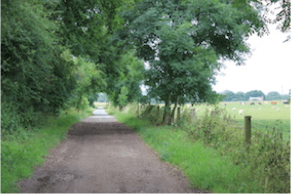
31. At the bottom of the road, as the road bends left, take the small, hard path directly ahead. This path takes us all the way back to Collingtree village

32. On reaching the top of the path, bear left onto Bear Corner & retrace your steps back to where you left your car
This has been an incredible walk & although 10 miles it was very enjoyable even in January
Go Walk!!